Kathmandu: Durbar Squares, Buddhist Stupas and Vibrant People
Kathmandu’s Layout and Geography
Upper and Lower Kathmandu
City Neighborhoods
New Kathmandu
Essential Kathmandu
Transportation
Best Visiting Times
How Long to Stay
As the sun rises over Kathmandu, the sounds of prayers and chanting mingle with the musical notes of puja bells. Soon taxi horns add to the early sounds before Radio Nepal welcomes the new day at 6 o’clock AM.
Visitors who want to look beyond the most obvious tourist destinations will enjoy the everyday energy of busy marketplaces and bazaars. Hindu temples and Buddhist stupas add points of interest to a stroll through the city. As you walk among the residents and other people from far and wide, your exploration may lead you down a quaint alleyway to buildings and courtyards that look like they came from years long past. Experience a vast array of sights, sounds, and intriguing odors as you are greeted with smiles on every side.
As the day goes on, the bustle intensifies as shoppers flock to Kathmandu’s open-air bazaars and shops. Stroll along in the flow of pedestrians and see what goods might catch your eye: porcelain bowls, brass pans, cloth or sewn saris in red, gold, and turquoise, orbs of brown soap, flowers in garlands and wreaths. Walk on to market stalls offering everything for the kitchen from rich golden turmeric, rainbows of lentils, and freshly butchered goat and other meats. The scents that fill your nose are a complex blend of butcher shop blood, the fresh tang of citrus fruits, flowers, and the mass of humanity around you. Above all, temple bells toll out and invite the faithful to pause and pray. Those too intent on shopping or business offer a reverent forehead touch as they rush on.
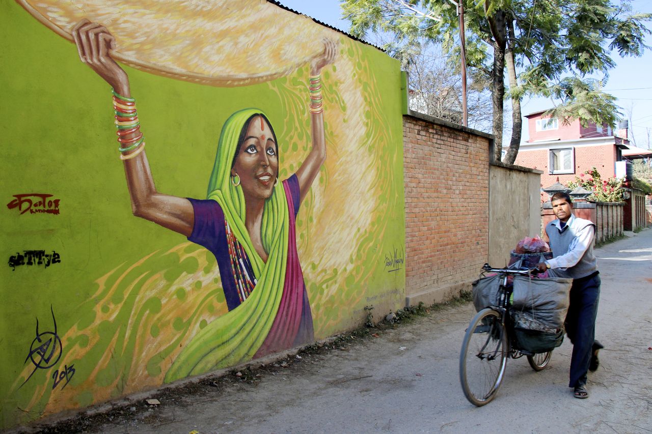
In 2012 a project to beautify the poorer areas of the city with colorful murals was initiated by Sattya Media Arts. Sixty artists partook in this one-year project called Kolor Kathmandu © Francesca Braghetta
Beyond the shopping district lies Thamel, the tourist quarter, with merchants and guides catering to those arrived from faraway lands. Sellers add their voices to the sound of popular 1960s music from restaurants as they invite you to check out their wares by calling “Bags! Carpets! Cheap prices!” loudly. Signs outside eateries promise delicious breakfasts, local dishes like moussaka, and ones from far away like French onion soup. Purveyors of services both useful and fun call out, “Massage?” “Money exchange – best rates!” and “Smoke?” in attempts to lure you into their shops.
Kathmandu holds within its boundaries a complex cornucopia of different times, peoples, and experiences. In these few blocks, experience contrasts unbelievably diverse. Outside a Durbar Marg luxury hotel, shepherds drive their flocks. Ancient buildings of brick and tile hold TV antennas aloft. Streets crowded with late-model cars also hold complacent cows happily chewing cud and scurrying porters. Traditionally-garbed women thresh grain right down the street from blue-jean-wearing punks.
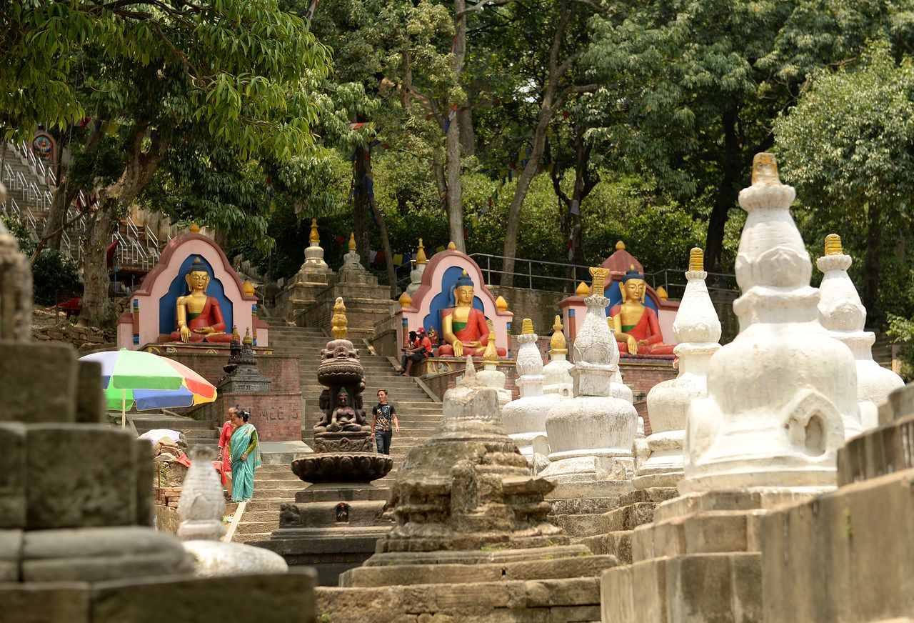
Some of the many statues and shrines to delight visitors and devotees in Kathmandu, the capital city of Nepal © Martin Applegate
Kathmandu’s Layout and Geography
The original cities that make up the valley – Patan, Bhaktapur, and Kathmandu – were supposedly laid out on purpose to coincide with sacred symbols of wheel, conch shell, and Manjushri’s sword respectively. These days, that idea has dwindled to mere legend as no trace of the shapes remain in the sprawling combination of the cities. Although the Vishnumati and Bagmati Rivers still form natural boundaries, many changes have taken place. What was once called Timmale is now Thamel. It, along with the combined sprawl of Kathmandu and Patan all attract global tourists interested in history, art, and culture.
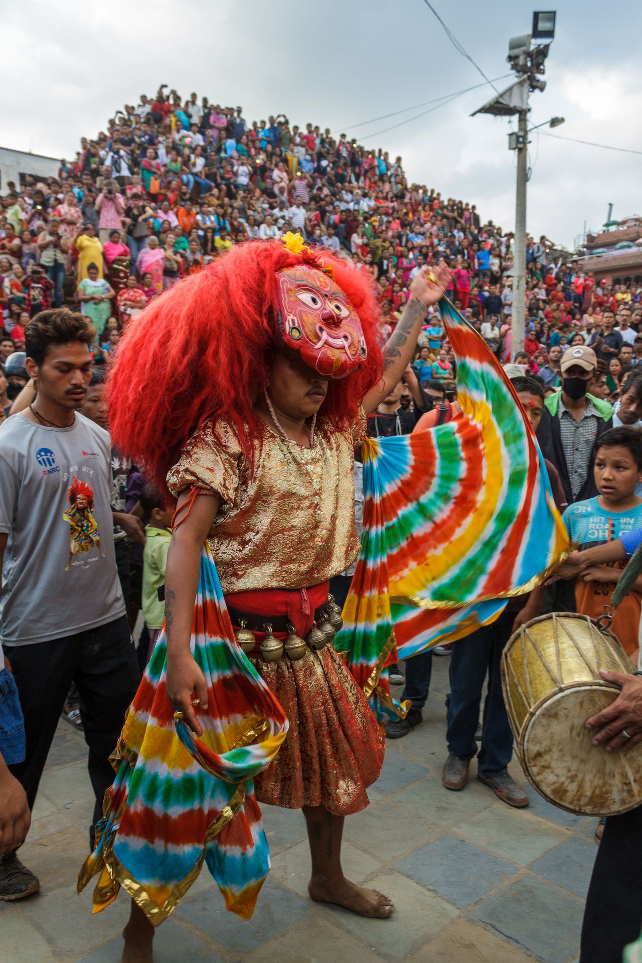
A Majipa Lakhey dance in Kathmandu Durbar Square draws a large crowd. Considered an important lakhe or demon in the folklore of Nepal, this © Jeff Cagle popular dance performance takes place during the Indra Jatra Festival
Upper and Lower Kathmandu
Kathmandu itself was founded at the juncture of the Vishnumati and Bagmati Rivers on a high piece of fertile land that could be defended more easily from outside attackers. The southern part is also called lower Kathmandu, while the northern is referred to as upper Kathmandu. These parts of the same region lived in conflict with each other for quite a while. An annual tradition pitted inhabitants against each other during Kumar Sasti, which is a festival day celebrating the warrior god. A stone-throwing fight occurred every year. If one side was able to wound an enemy, they would capture him, drag him away, and use him as a temple sacrifice. It was not until a British man watching the event was hit by a stone that the tradition was ended in the 1870s.
Makhan Tol in Durbar Square marks the spot where upper and lower Kathmandu divide. Visitors frequently go north of the square to explore, shop, and see sights in the popular commercial districts of Asan Tol, Chhetrapait, Indra Chowk, and Thamel. The southern side of Durbar Square extends into residential area occupied by Newar Jyapu peasants.
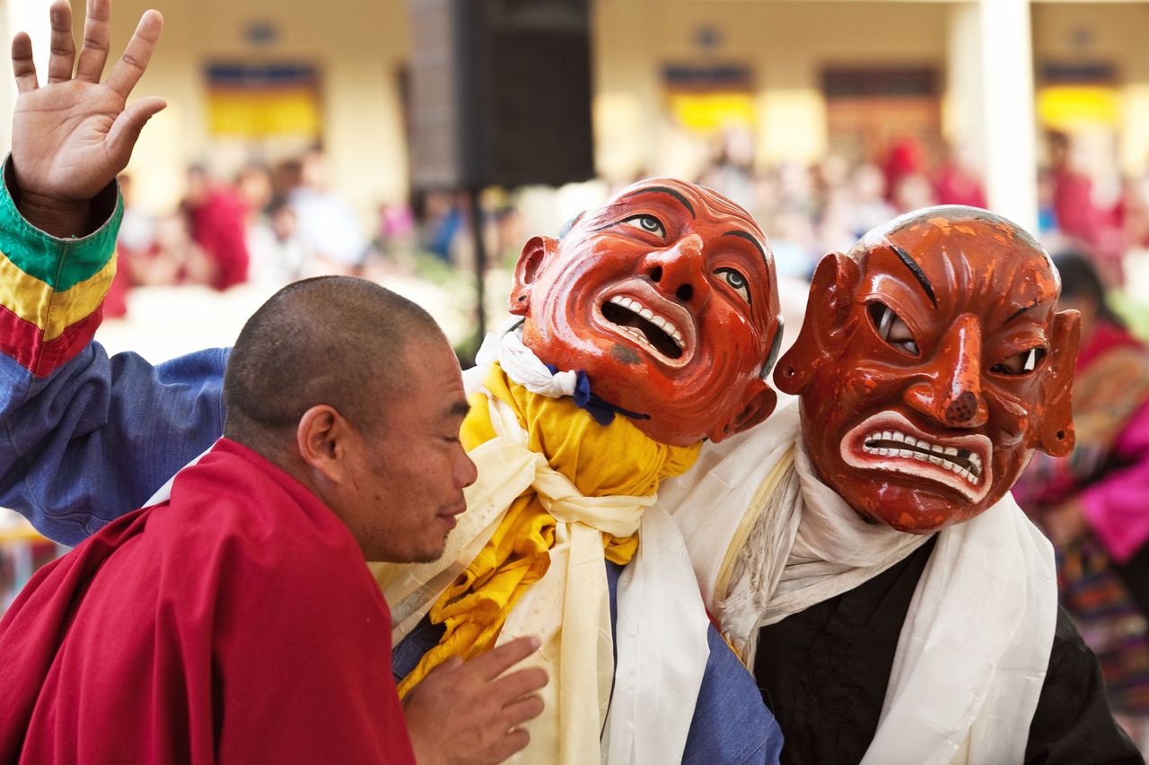
A Buddhist monk and two masked lamas take part in the Losar Festival during the Tibetan New Year celebrations at Shechen Monastery in Baudanath in the Kathmandu Valley, Nepal © Storm Is Me
Even though Kathmandu is now the largest it has ever been, travelers find it easy to walk anywhere in it they want. The most-frequently visited areas take up approximately 5km square. The Vishnumati River forms the western boundary, Tundihel and Kanti Path the border to the east, the Bagmati River on the southern edge, and Thahiti on the northern side.
Despite its small size, navigating the maze of small street and alleys can confuse people who do not live there. The city authorities have plans to create an organized system of street addresses, but most locations have no numbers or names to help. If you ask someone for the location of a point of interest, they may respond with the tol or neighborhood name and a general direction. The neighborhoods themselves are unmarked and boundaries only for local people to understand. You may also be told to take a left at a particular shrine, a right at a local stupa, and go straight past a particular noticeable garbage dump till you reach your destination. With a good sense of adventure and patience, visitors can find their way around.
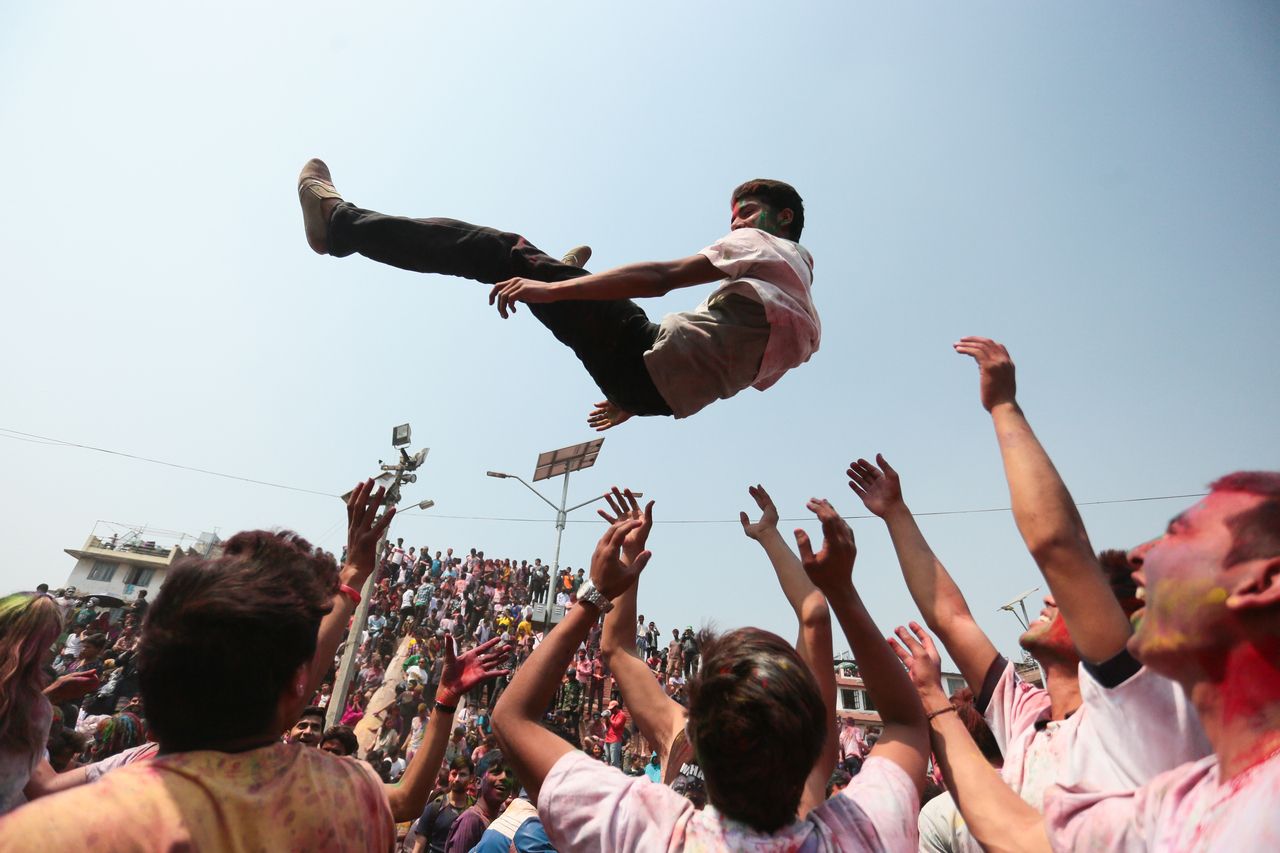
People having fun during the popular Holi Festival, the largest celebration in Asia. Also called the Festival of Colors, it is marked by lots of fun and excitement to celebrate the arrival of spring © udeyismail
City Neighborhoods
Wander through the old city to find neighborhoods with unique and whimsical names for suburbs such as Kalimati (Black Dirt), Sorha Khuttapati (Sixteen-legged Resthouse), Gyaneshwar (Wise Lord), Baneshwar (Forest Lord), and Batas Putali (32 Butterflies). The older neighborhood Nag Sala (Kingdom of the Naga) has now become Naxal. So many names for parts of the city and streets within it can make for confusing navigation. Street numbers are not common.
While finding a specific location can create a challenge, the alleys, courtyards, hidden shrines, and buildings tucked tightly together off the main roads are a joy to discover. Although the Schneider map of Kathmandu can help you find shrines, stupas, and chaitya of interest, you can wander without a map too. The overall area is rather small and visible landmarks and known streets are always just a short walk away.
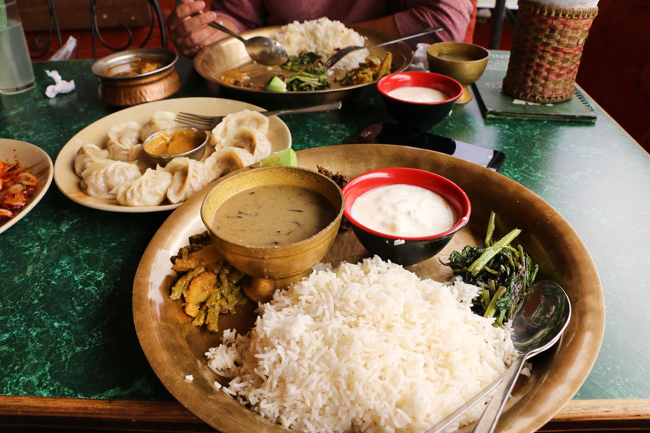
Dal bhat is a typical dish of the Nepalese cuisine, consisting of momos, steamed rice, lentil stew and greens © Kondoruk
New Kathmandu
The two main streets in Kathmandu are the Durbar Marg, considered the premier street, and the Kanti Path to the west. The former holds many travel agencies and expensive hotels. The latter starts in the north at Maharajgunj and Lazimpat embassy properties and stretches south to the Patan bridge. In the block of space between these top streets, you can see the Tundikhel parade grounds that are a fine demonstration of old Raj traditions. Other points of interest nearby include the city bus depot and the city’s major post office. Stroll a few minutes away to New Road, enjoy the shops, and then head directly to Durbar Square to see the sights.
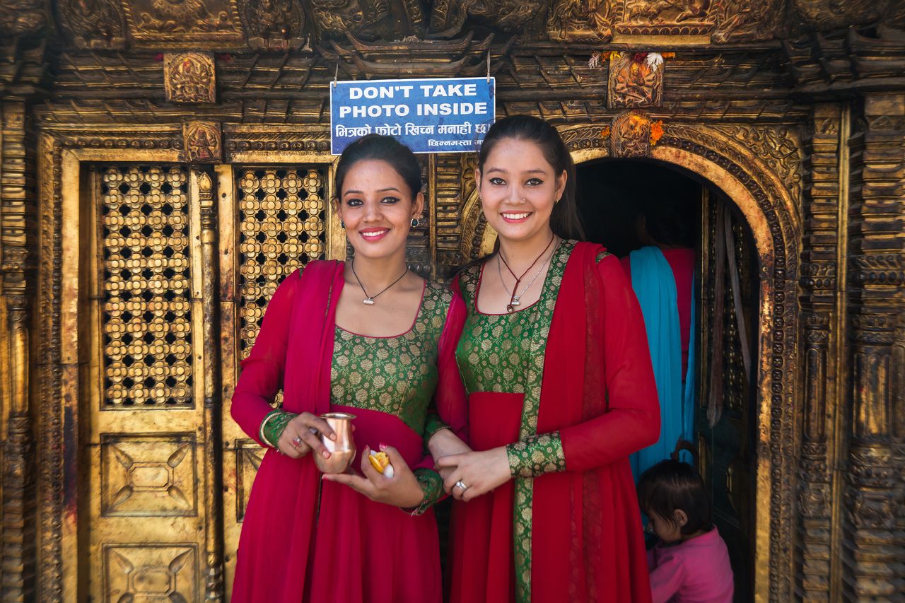
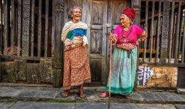
Two ladies visiting a Vishnu temple in Kathmandu. Nepal has the world’s highest percentage of Hindus, around 81%. The rest are mostly Buddhists © Hung Chung Chih
Essential Kathmandu
Arrival
The Tribhuvan International Airport is the only entrance for international visitors who travel by air. Located conveniently just 5km east of the city, travelers usually opt to stay in the city center itself. From the Arrivals desk, you can hire a taxi who will carry you and your luggage to popular hotels and destinations. The set price at the current time is Rs800 or US$7.30. Independent taxi drivers are available at discounted rates, but visitors should beware for serviceable vehicles and trustworthy drivers.
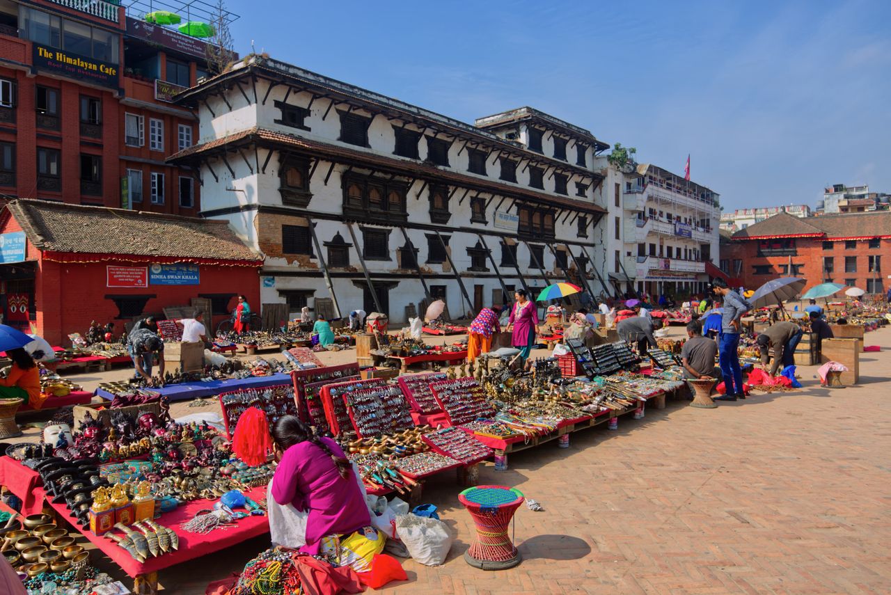
Vendors exhibit their handiwork of souvenirs, jewelry and much more on Basantapur Square near Kathmandu Durbar Square © kridsada kamsombat
Transportation
The center of Kathmandu Durbar Square and the Old Town district is best experienced on foot. Points of interest are close together and the streets are safe as long as you dodge traffic and motorbikes carefully. The city center offers minibus service, but these fill up with locals quickly and do not have any clear indication of their destinations. Instead of signage, the drivers call out where they are going. For visitors, this mode of transportation can lead to confusion and ending up somewhere you did not intend to go.
For those who choose not to walk everywhere and for day trips to temples, shrines, and other locations outside of the city center, taxis are a good choice. Most taxi drivers know sufficient English to understand where you want to go, tell you about the best hotels and restaurants, and also haggle over the price of the trip.
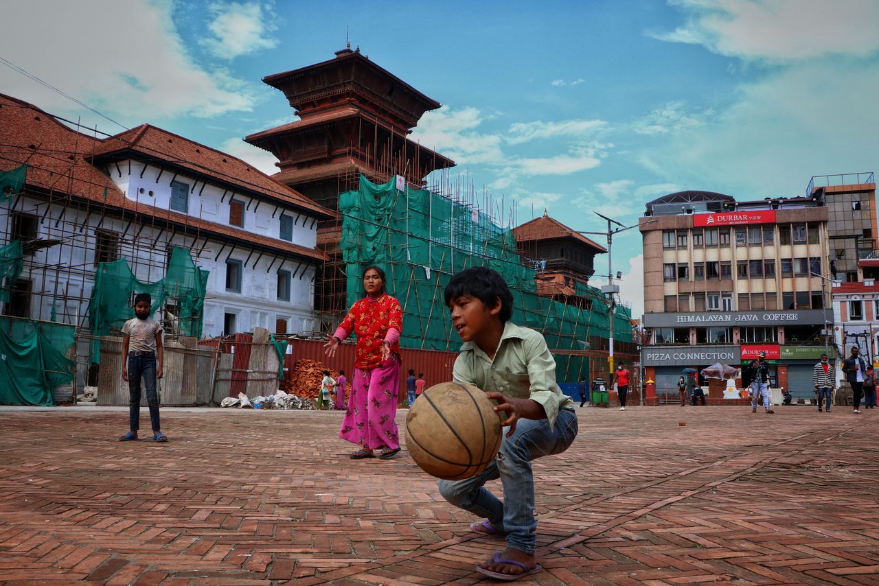
An impromptu soccer game in Basantapur Durbar Square in Kathmandu during the Covid pandemic © Sanjit pariyar
Best Visiting Times
The best times to visit Kathmandu depend largely on your comfort and what you wish to see. The June to September monsoon season is sultry and hot with frequent rainstorms. Pollution is at a minimum and the foliage and flowers of the region bloom everywhere. From October to November combine some of the heat of summer with evenings comfortably warm. The monsoon rains retreat leaving the air clearer and less dusty. The December and January months are cooler with late night temperatures never dropping below 1C. Sunny days provide excellent views of the Himalayan mountain peaks while occasional rain invites visitors to pursue indoor activities. Spring comes in February and March with comfortable temperatures.
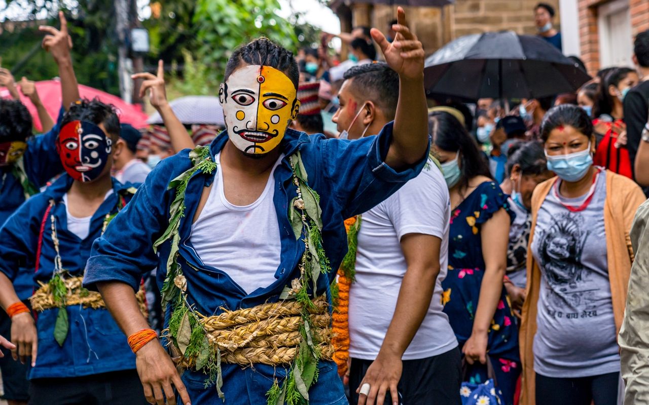
The Gai Jatra Festival is a yearly event to commemorate the passing of relatives. Humor and satire are employed in programs to lessen the pain of losing loved ones © gorkhe1980
How Long to Stay
If you only want to see the most famous tourist destinations, two or three days will suffice. However, the richness of the area means that seven days or more would not be wasted if you wish to explore the entirety of Kathmandu.
Note:
The museums you find in Kathmandu itself are quite out-of-date and under-funded. Consider short treks to Patan and Bhaktapur to visit their museums instead. The Patan Museum is one you should not miss. It features exhibits full of intriguing information about Nepali life, arts and crafts of the area, religion, and history. The museum’s garden café is a favorite stop for refreshments.
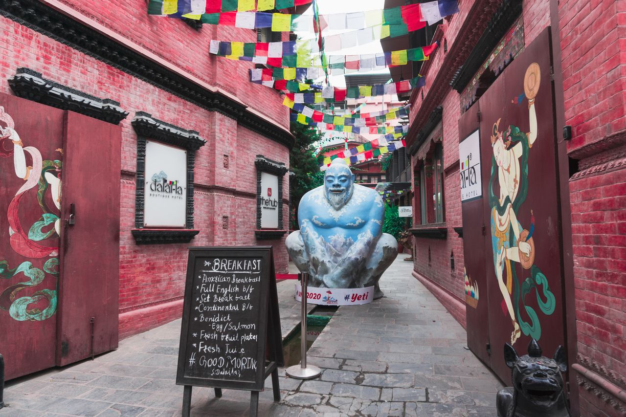
Impressive blue statue of the Yeti, the legendary abominable snowman. Colorf© gorkhe1980ul prayer flags span the walkway © CrisMC
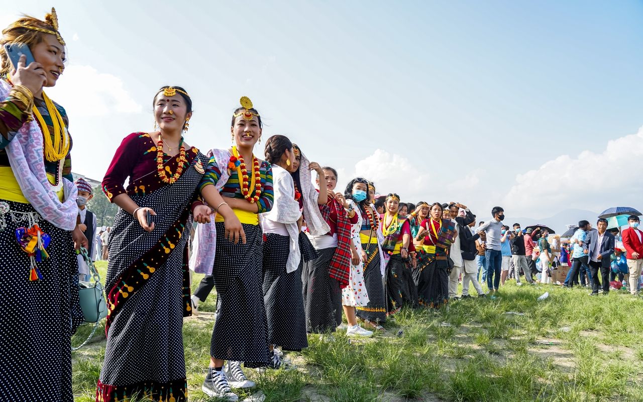
A group of female dancers ready to perform their traditional dance during the Ubhauli Festival when good fortune and a good harvest for all is celebrated, Kathmandu © gorkhe1980
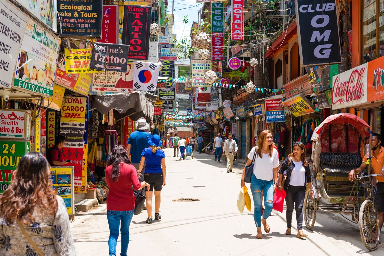
One of the busy streets in Thamel. This district is the hub of the tourist industry with a wide selection of restaurants, bars, and shops selling anything from trekking gear to clothes © Constantin Stanciu
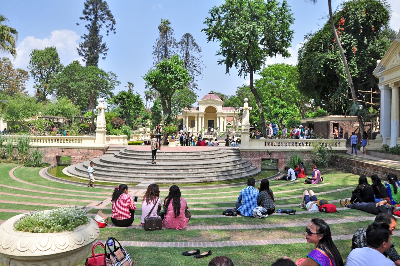
The Garden of Dreams is popular with locals and tourists alike. The garden was built in 1920 and is a real oasis right in the heart of the Thamel district in Kathmandu © Wojtek Chmielewski
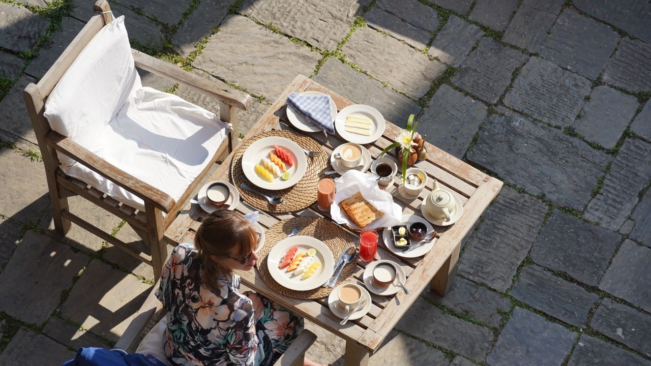
A foreign tourist enjoys her hotel breakfast outside in the fresh air in Kathmandu, Nepal © chrisontour84
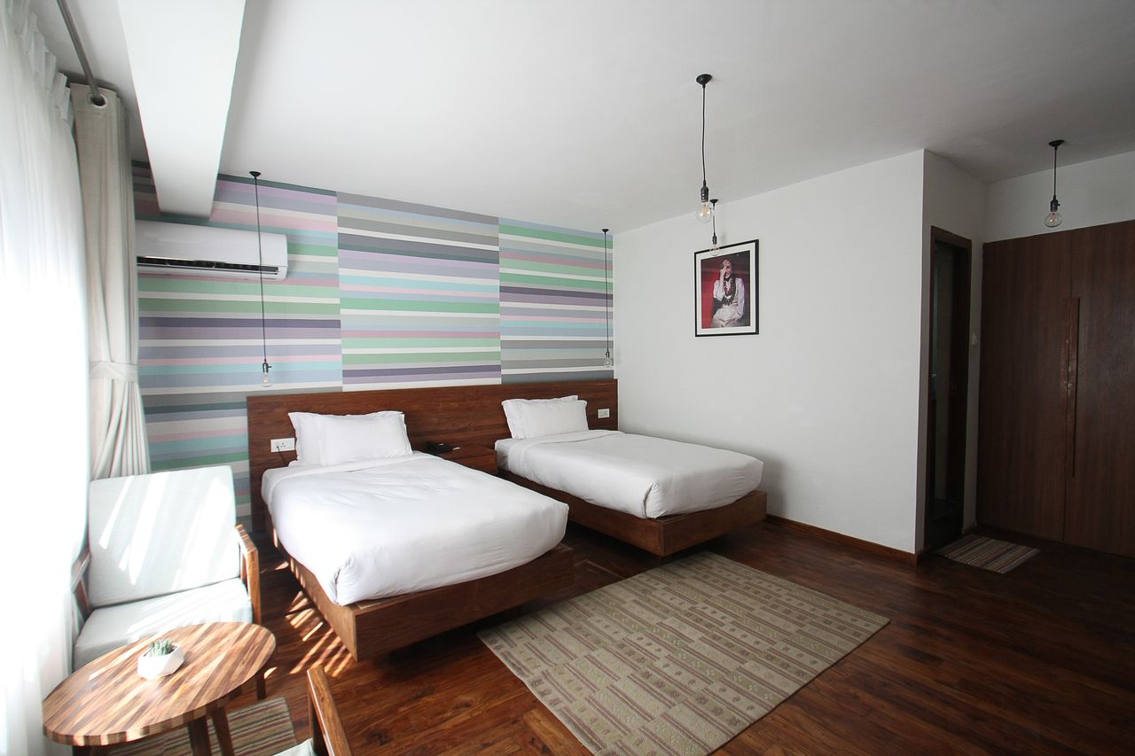
A comfortable, luxury hotel room awaits guests in the vibrant neighborhood of Thamel, Kathmandu © Kondoruk
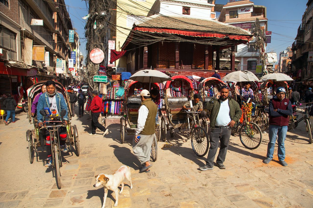
Three-wheeled rickshaws stand ready to transport passengers. This is the vehicle of choice for short distance transport in Kathmandu © Daniel Prudek
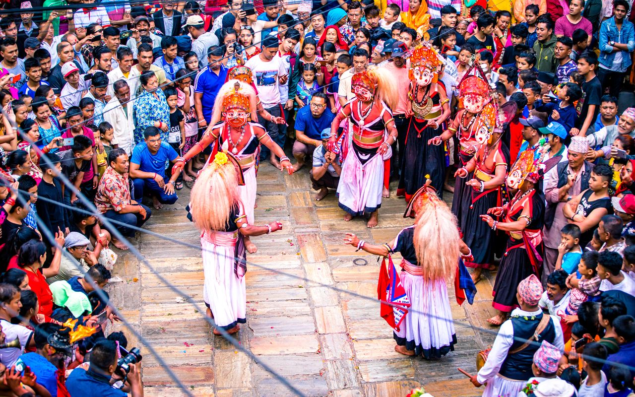
People dressed in costumes with elaborate headdress perform a dance during the four-day Nil Barahi Dance Festival at Bode in Bhaktapur. Dancers pose as various deities during their performances © gorkhe1980
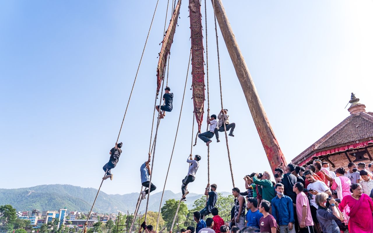
Men scale ropes during the local community celebrations of the Biska Festival in Bhaktapur. The festival takes place at the start of the new year © gorkhe1980
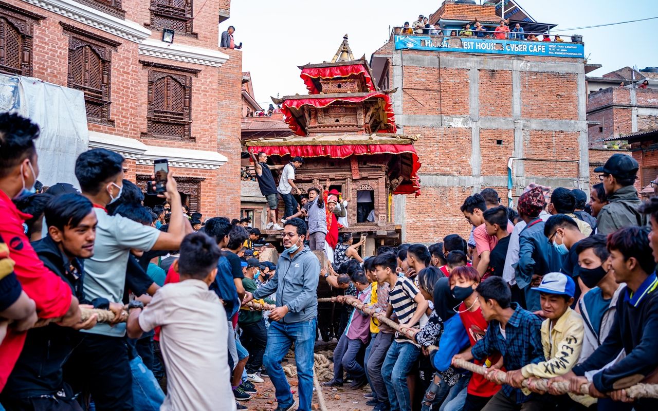
During the Biska Festival hundreds of people pull a chariot with the statue of Bhairava from both sides in a mock tug of war game between the upper and lower neighborhoods of town © gorkhe1980
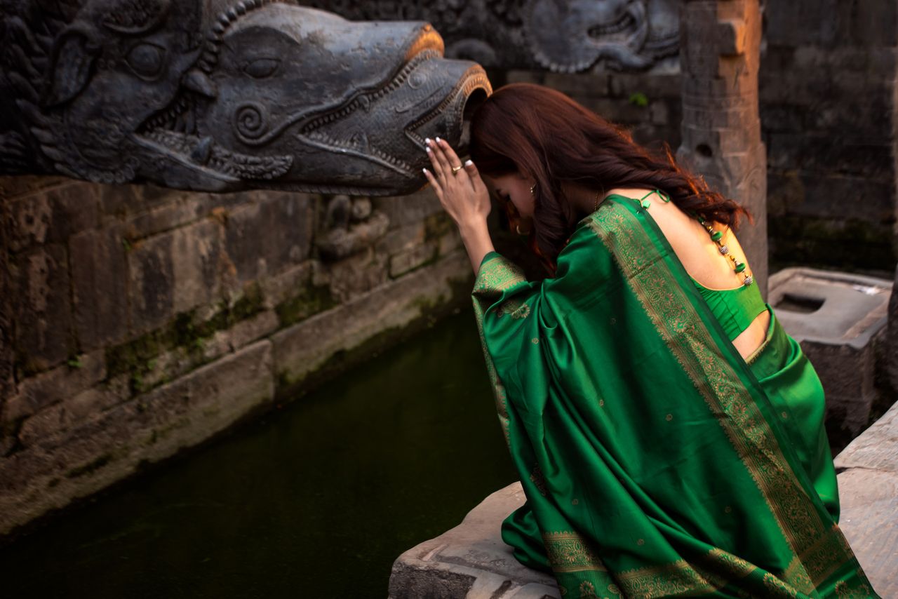
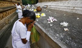
A devotee performing a spiritual ritual at a temple in Kathmandu, Nepal © Nong2
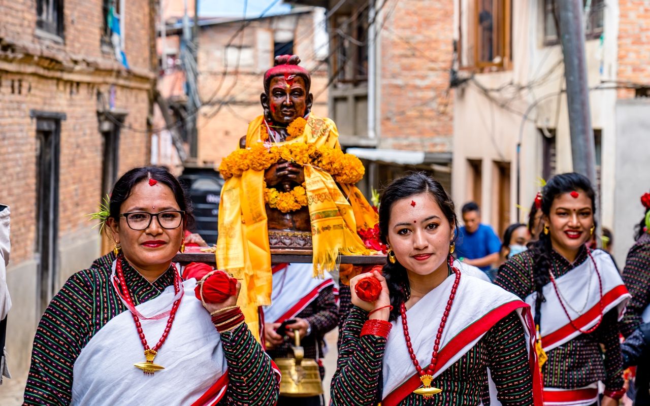
During the Biska Festival hundreds of people pull a chariot with the statue of Bhairava from both sides in a mock tug of war game between the upper and lower neighborhoods of town © gorkhe1980
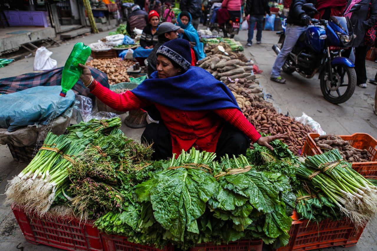
A vegetable vendor refreshes her produce with water at a street stall. About 76% of the working population of Nepal are involved in agriculture © udeyismail
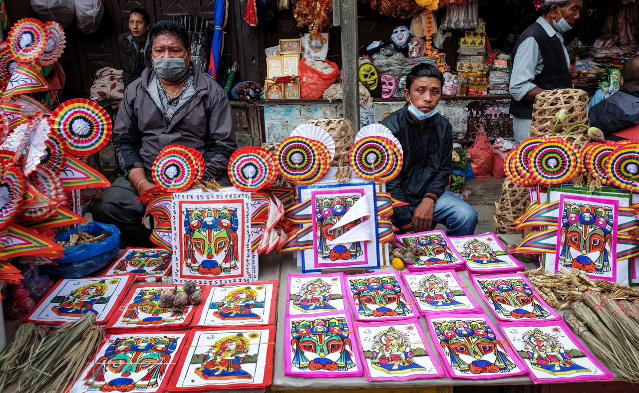
Vendors sell cow-head masks to patrons for the Gai Jatra Festival during which those who have died during the previous year are remembered and honored. The festival is celebrated mainly amongst the Newari people © SharmaSunil
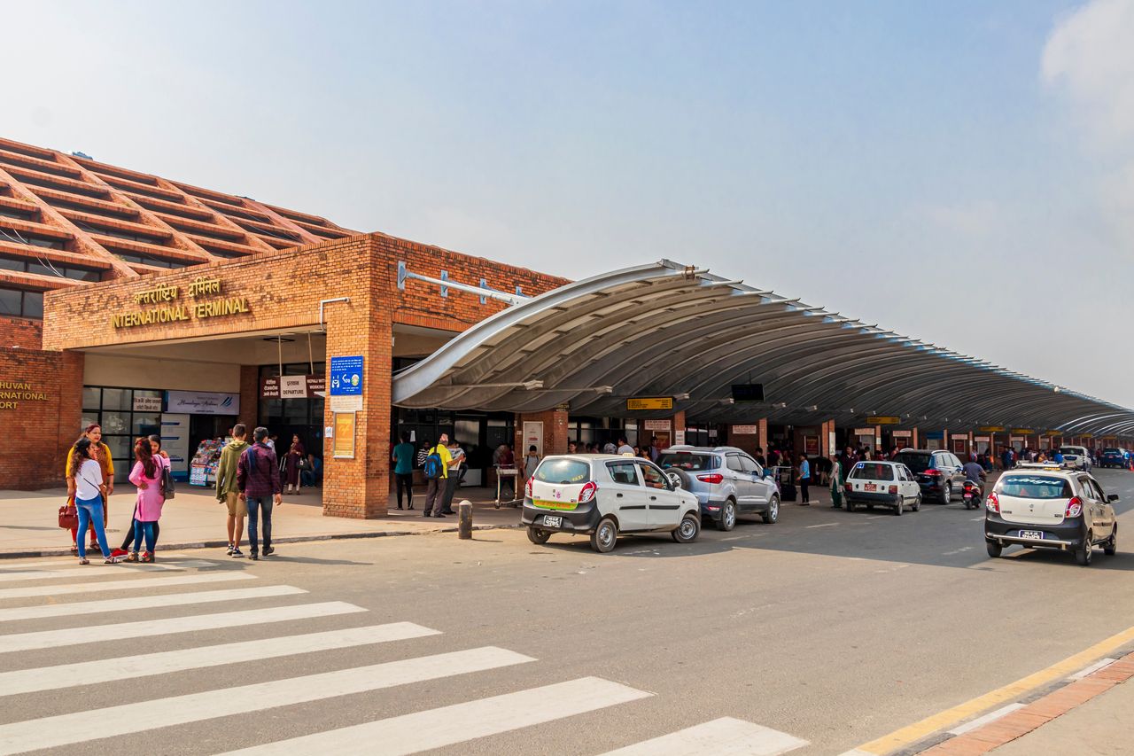
International Departures at the Tribhuvan International Airport in Kathmandu. It connects Nepal with forty destinations in seventeen different countries © Arkadij Schell
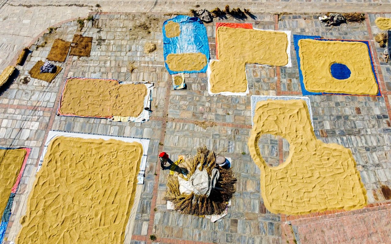
The paddy field harvest is dried in the sun. The grains are spread on mats and are ready in one or two days © gorkhe1980
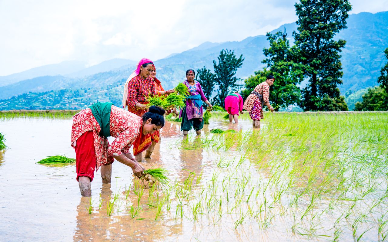
Women working in the paddy fields outside Kathmandu. Rice cultivation is mostly still done the traditional way in Nepal and is quite labor intensive © gorkhe1980
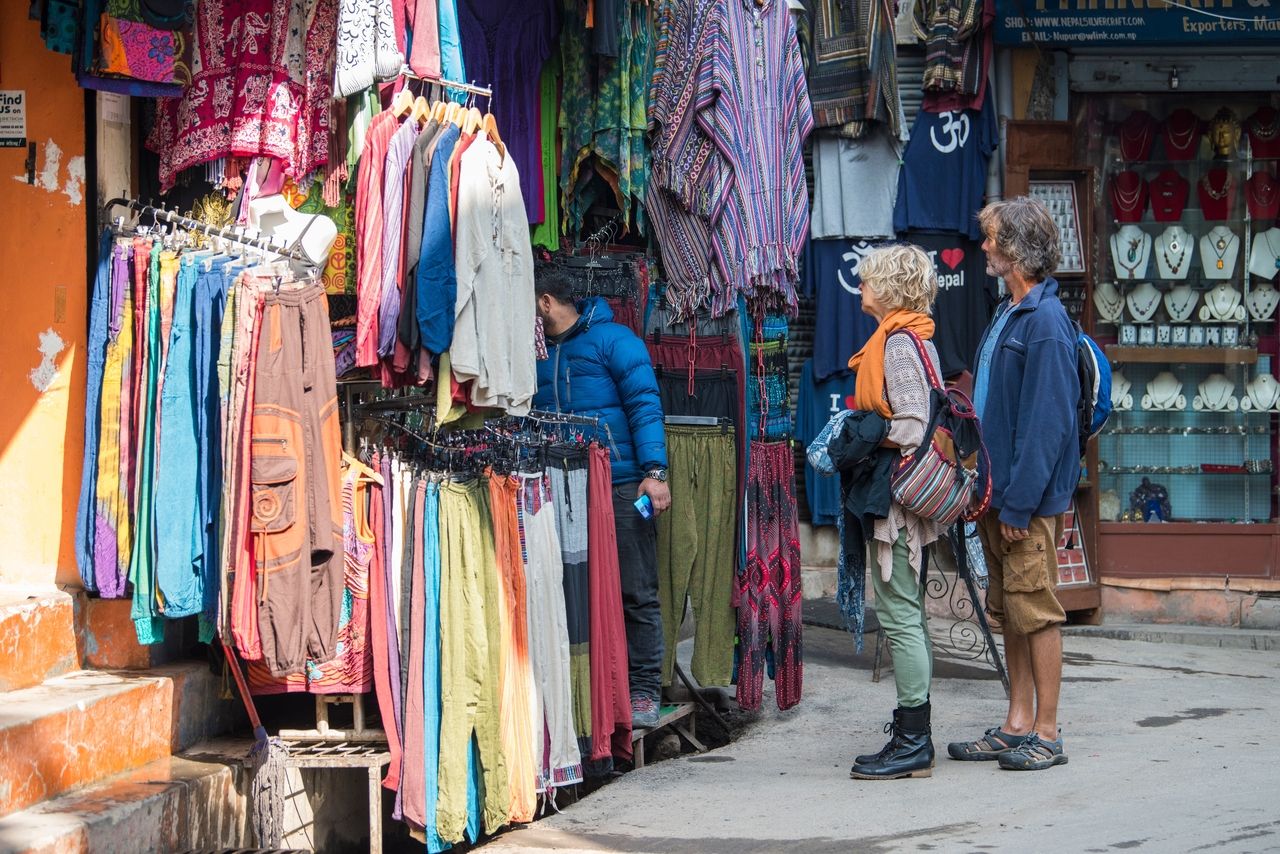
Foreign visitors shopping for clothes at a store in one of Kathmandu’s busy streets © Shadow of light
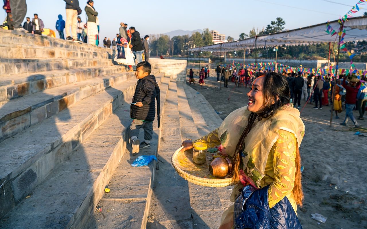
A Hindu worshipper on her way home after celebrating the four-day Chhath Puja Festival during which people bathe in the Bagmati River and bring offerings to the Sun deity © gorkhe1980
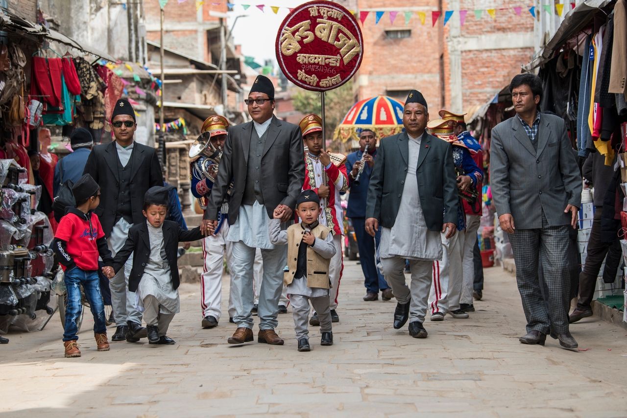
A small brass band accompany a wedding procession dressed in traditional costume in Durbar Square in the heart of Kathmandu, Nepal © Shadow of light
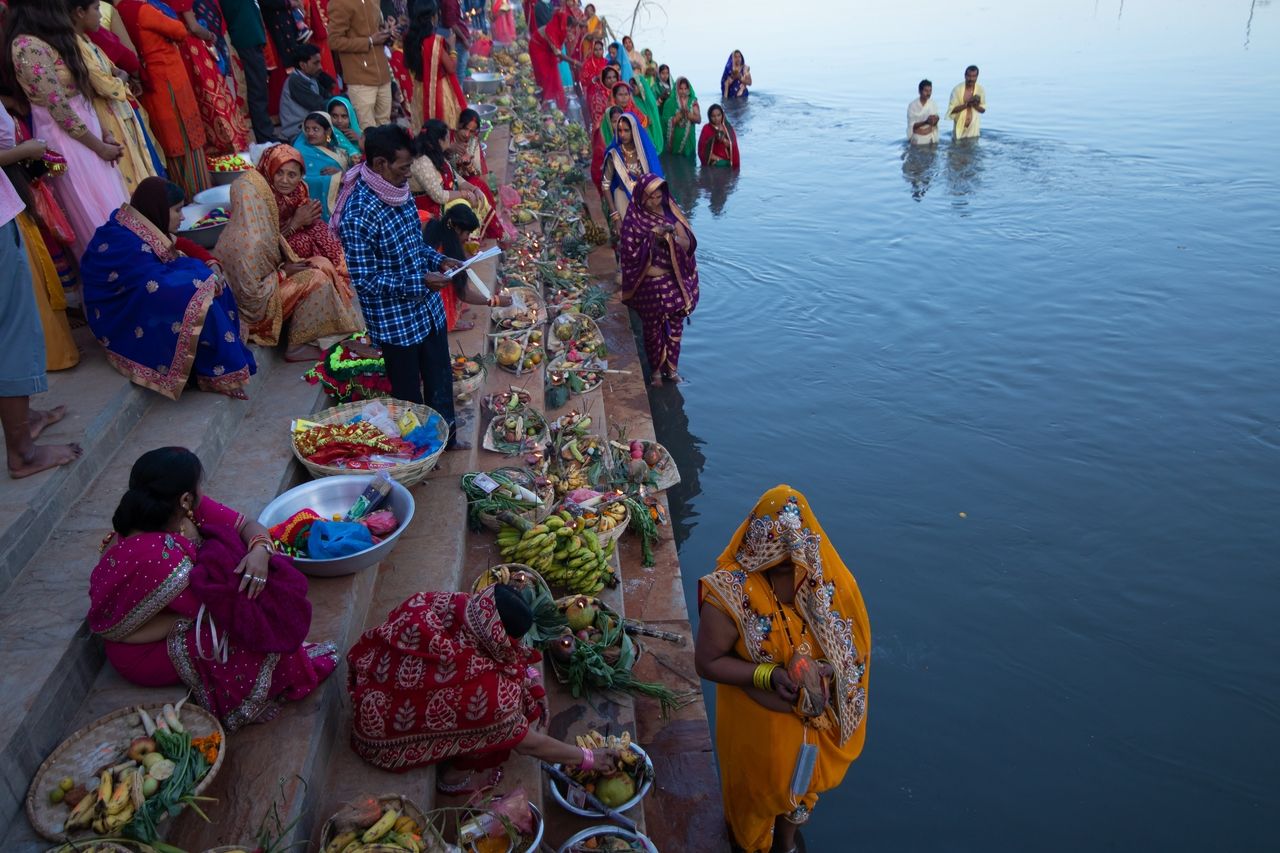
Chhath Puja is an ancient Hindu festival to celebrate the Sun deity and his wife. Devotees present their offerings to the setting sun on the ghats of the sacred Bagmati River © Rojen Maharjan
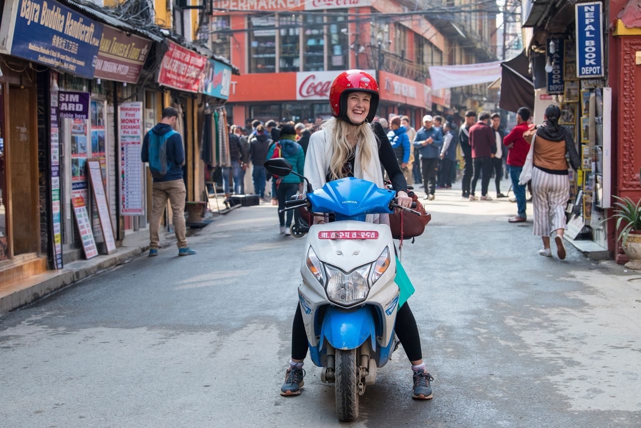
A tourist exploring the busy streets in the center of Kathmandu, the capital of Nepal. More than a million visitors come to this city every year © Shadow of light
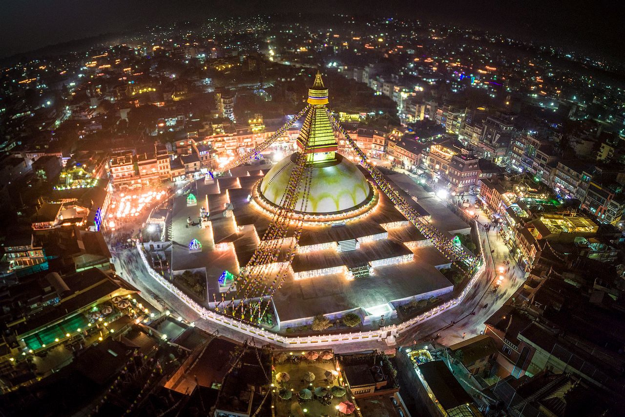
The tremendous size of the Boudhanath Stupa is evident in this bird’s eye nighttime picture taken during Tihar, the five-day Festival of Fire to celebrate the relationship between animals like monkeys, cows and oxen and people © MaxxjaNe
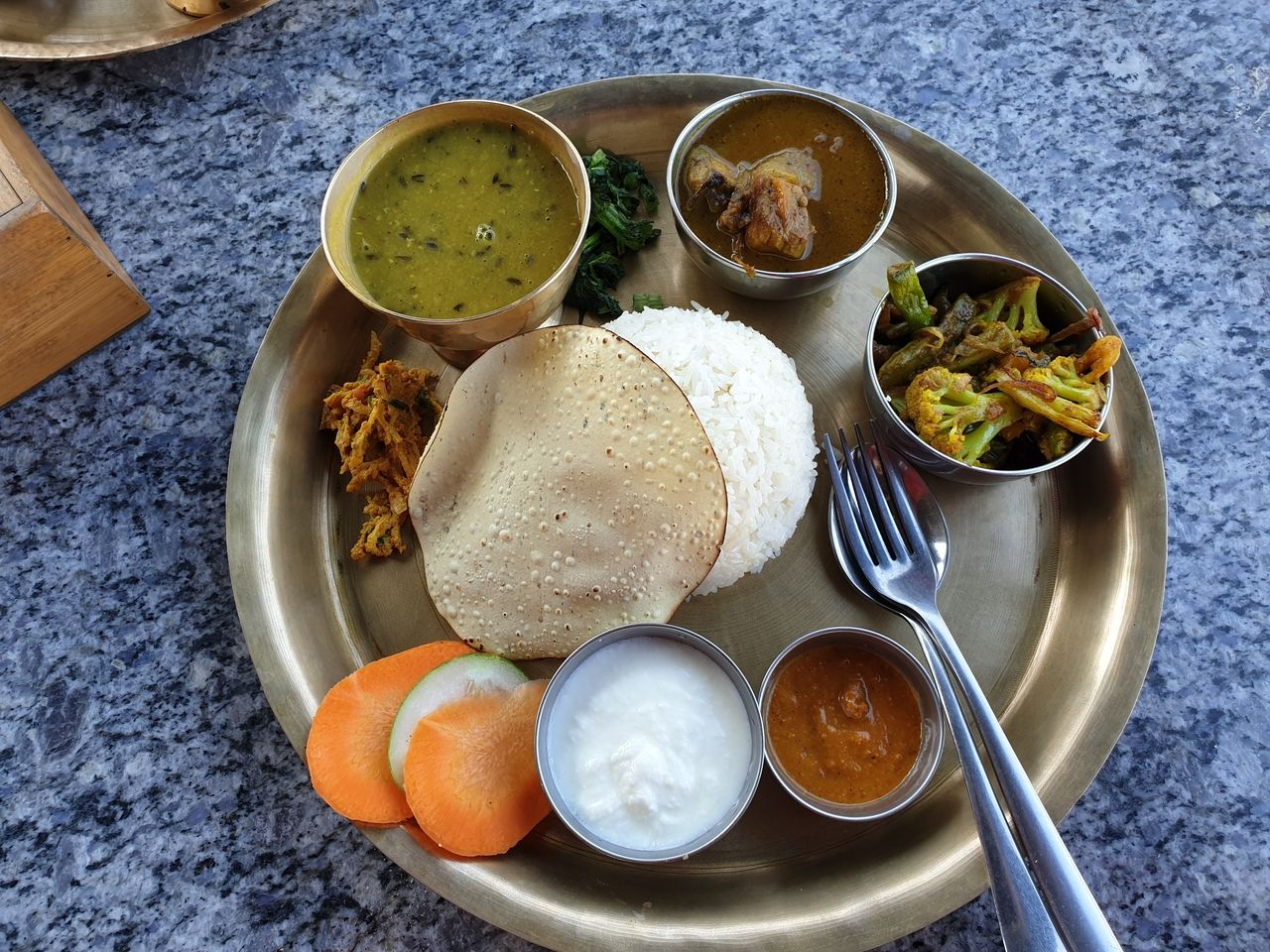
One of Nepal’s staples is Thakali thali, with lentils, steamed rice, green vegetables and meat © Dheer85
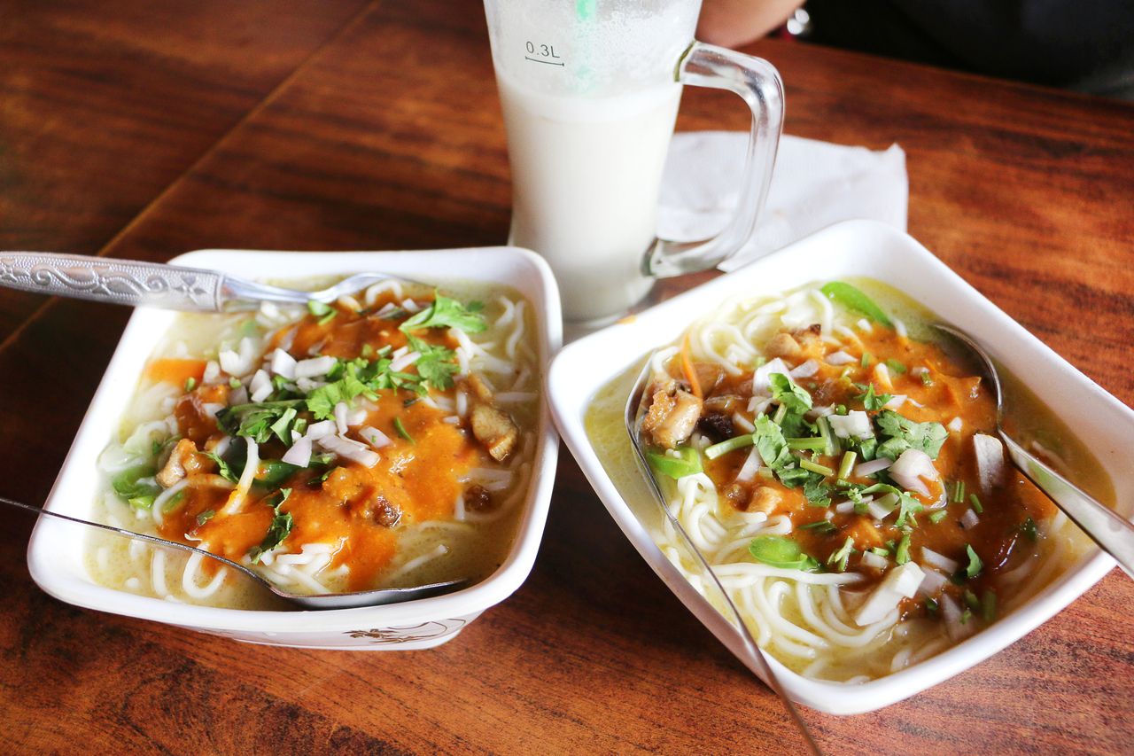
Two meals of Thukpa, one of Nepal’s traditional dishes. This chicken noodle soup is hearty and fragrant, easy to prepare and especially popular in the northern Himalayan region of Tibet © Kondoruk

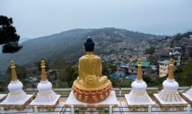
Massive golden statue of the Buddha in Kathmandu, Nepal © Skreidzeleu



![Golden Triangle Tour with Goa [Culture + Beach Vacation] (12 days) Golden Triangle Tour with Goa [Culture + Beach Vacation] (12 days)](https://www.vacationindia.com/wp-content/uploads/2022/06/golden-triangle-tour-with-beach-vacation-270x160.jpg)
